

REVIEW · LAKE WANAKA ADVENTURES
Wānaka: Scenic Helicopter Flight Wānaka Max
Two alpine landings make Wānaka feel huge. In 45 minutes, Wānaka Max adds alpine landings and a proper touchdown at Mt Roy, with views that stretch from the Matukituki River to Lake Hāwea. You’re not just looking out a window, you’re getting out onto mountain rock.
The only real catch is timing, this flight can be weather-dependent, and your exact departure may shift. The company will do its best to match your preferred time, but your flight is confirmed by the team within 24 hours.
Key things to know before you go

- Two alpine landings: one is a mountain peak touchdown, plus another alpine landing included in the experience
- Mt Roy at about 4,000 feet: you get a wide panoramic viewpoint over Lake Wānaka and the township area
- Matukituki River valley pass: a classic, dramatic aerial sweep of the valley and native bush
- Mou Waho Island, lake within a lake: a striking protected nature reserve view from above
- Mt Aspiring National Park scenery: snow-capped peaks and glacier-carved valleys in one circuit
- Lake Hāwea vs Stevensons Arm: clear contrast in water shapes and surrounding terrain as you return
Wānaka Max in real life, 45 minutes that feel like more

For NZ’s South Island, Wānaka is already a showstopper from the ground. Wānaka Max takes that same scenery and changes your scale fast, because you’re high enough to see how everything connects. Rivers, lakes, and mountain walls start to read like one big system.
The flight is 45 minutes, with two alpine landings. At $298 per person, it’s not cheap, but you’re paying for access, height, and landing on viewpoints most people only photograph from far away. If you love landscapes from a distance, this is what it looks like when you get closer, without the slog.
Also, it tends to feel like a small-group experience. That matters, because your pilot can concentrate on flying the route and calling out the good angles rather than doing a big, noisy tour.
From Wanaka Helicopters office to lift-off, the flow that keeps it calm
You meet at the Wanaka Helicopters office in Wānaka. Check-in is straightforward, and you can skip the ticket line, which helps if you arrive with limited buffer time.
Once you’re in, the experience is very pilot-led. The tour includes an English live guide, and in practice the pilot is usually the person narrating what you’re seeing and pointing out standout features along the way. Names you might hear in this context include Travis, who is called out in past experiences for combining clear guidance with smooth flying.
You should also plan for a quick transition from waiting to flying. This is not a half-day excursion, so if you’re the type who wants lots of downtime, you’ll want to treat this as the main event for that window.
Matukituki River valley: where the scenery turns into a story

One of the first things you’ll notice from above is how the Matukituki River valley shapes everything around it. You get that valley corridor view, where the river lines up with steep walls and pockets of native bush. It’s the kind of scene that’s hard to fully understand on a lookout, because your eyes can’t track the whole drainage pattern.
Aerial views are particularly good here because you can see the scale of the terrain in one glance. From the ground, you might spot a river bend. From the air, you understand the route it takes and how the mountains funnel water through the valley.
This segment also sets up your landing mindset. When you later touch down high up, you’ll appreciate what you were looking at from above, and the route starts to feel intentional rather than random.
Coromandel Peak (Mt Roy) landing at 4,000 feet: the moment you tell people about
The signature highlight is the alpine landing at Coromandel Peak, known as Mt Roy. It’s described as one of Wānaka’s iconic viewpoints, and when it’s available you’re lifted high enough to appreciate why people remember this place.
The landing happens at about 4,000 feet. From there, the panoramic view is the point. You’re looking over Lake Wānaka, the township area, and the wider country beyond, and you get a real sense of the bowl shape that makes Wānaka special.
What makes this landing valuable is the change in perspective, you’re not only watching the scenery. You’re standing in it, briefly, which makes photos easier and memories clearer. The contrast of being on a peak and then climbing back into the aircraft is a big part of why the experience scores so high.
One practical consideration: this is typically weather and safety dependent, so while the Mt Roy landing is part of Wānaka Max, you should keep in mind it can be limited by conditions on the day.
Mou Waho Island: the lake-within-a-lake view that looks unreal
Next comes a viewpoint that’s genuinely hard to explain until you see it. Mou Waho Island is part of a protected nature reserve, and you get that famous lake within a lake effect from above.
From the air, the geometry makes sense. You can see how water sits in a way that creates that layered look, almost like a reflection but not quite. If you’ve ever felt that drone footage looks too perfect, this is where it flips. Aerial reality can look staged, but the shape here is natural and distinctive.
This section is also a good reminder that Wānaka’s value is not only the big hero mountains. It’s the smaller, weird details, the protected islands, the water patterns, and the way everything fits together.
If you’re traveling with someone who thinks helicopter flights are only about thrill, this is where you can win them over. The view is unusual, not generic.
Mt Aspiring National Park: snow peaks and glacier-carved valleys from the air
Wānaka Max includes views into Mt Aspiring National Park, a World Heritage-listed area. The big promise here is drama: snow-capped peaks and glacier-carved valleys.
What you’re really getting is a different kind of mountain reading. Up close, you see texture. From the air, you see structure. You can spot how glaciers shaped the valleys, then connect that to where rivers and lakes sit today.
This is also one of those moments where the pilot’s route choice matters. A good pilot times angles so you get the clearest view of high ridgelines and steep valley cuts. Even if you’re not a geology person, you’ll feel the difference between a simple mountain backdrop and a landscape shaped by ancient ice.
Keep your camera ready, but don’t forget to look up with your own eyes for a few seconds. The snow line and the valley shape are the kinds of details you’ll want to keep in your brain as much as in your phone.
Lake Hāwea and Stevensons Arm: the contrast that makes Wānaka click
As the flight circuit continues, you get a focused comparison between Lake Hāwea and Stevensons Arm. This is one of the most useful segments for first-time Wānaka visitors, because it clarifies the region’s layout.
Lake Hāwea gives you a smooth, readable water shape. Stevensons Arm adds jagged edges and sheltered stretches, with the terrain shaping how the water appears. From the air, the contrast is obvious, and it makes the region feel like a connected puzzle.
You’re also getting movement in the scenery. This part is not a single pull-off viewpoint where you stare at the same horizon. You get a guided sweep, so your brain can track changes in water, rock, and slope as the helicopter turns.
Then you finish with that return perspective over the Wānaka township. It’s like the final page of the story, where you see how all the wild scenery sits beside the town you’ve been walking around.
Price and value: is $298 worth it here?
Let’s talk value in a practical way. $298 per person for a 45-minute helicopter flight is a splurge. If your travel style is mostly self-guided hiking and slow views, you might feel that’s too much.
But if you’re short on time, if you dislike long drives, or if you want the rare experience of landing on alpine ground, it starts to make sense quickly. This tour isn’t only scenic flying. It includes two alpine landings, including the iconic Mt Roy landing when available. That landing component is the part that turns a photo tour into a real, memorable experience.
So who is it best for?
- Couples or friends who want a one-time, high-impact highlight
- People with limited mobility who still want mountain views without hikes
- Visitors who love photography and want aerial angles that are hard to recreate by foot
- Anyone who’s seeing Wānaka for the first time and wants the big-picture geography fast
If you’re the type who can spend hours hiking and living on the same viewpoint, you might still enjoy this, but you should see it as a supplement. It’s a shortcut to perspective, not a replacement for the region’s longer scenic adventures.
Should you book Wānaka Max?
I’d book Wānaka Max if you want a top-tier Wānaka highlight that goes beyond views from the road. The combination of two alpine landings, the Mt Roy touchdown when available, and the aerial route over the Matukituki River, Mou Waho, Mt Aspiring National Park, and the Lake Hāwea and Stevensons Arm contrast is exactly the kind of trip that feels worth the cost.
I would hesitate if your schedule is extremely tight or you hate uncertainty, because weather can delay or postpone flights. Also, if you prefer slow sightseeing with time on the ground, you might find 45 minutes short.
If you can be flexible and you want a true once-in-Wānaka moment, this is one of the strongest ways to see what the region looks like from above.
FAQ
How long is the Wānaka Max helicopter flight?
The Wānaka Max experience lasts 45 minutes.
Where do I meet for the flight?
You meet at the Wanaka Helicopters Office.
What is included in the Wānaka Max experience?
It includes two alpine landings and guided narration in English, with standout aerial views of the Wānaka region.
Do you definitely land at Coromandel Peak (Mt Roy)?
The Coromandel Peak, also known as Mt Roy, landing is included if available.
What sights do you fly over during the circuit?
You should expect views of the Matukituki River valley, Mou Waho Island with the lake-within-a-lake effect, Mt Aspiring National Park, and the contrast between Lake Hāwea and Stevensons Arm, plus a return view over Wānaka township.
Is there a live guide on board?
Yes, there is a live tour guide in English.
Is this experience wheelchair accessible?
Yes, it is listed as wheelchair accessible.
Are meals or drinks included?
No, meals and drinks are not included.
What if weather or pilot availability affects the flight time?
Even if your booking starts as confirmed, the operator may need to cancel or postpone the flight due to weather or pilot availability. Your team will do its best to accommodate your desired time, and your flight will be confirmed by the team within 24 hours of your booking.
More Tour Reviews in Wanaka
- Wildwire Wanaka- Level 2 (4 Hours)
★ 5.0 · 467 reviews - Bike the Wanaka and Hawea Trails
★ 5.0 · 346 reviews - Lake Wanaka Happy Hour Cruise
★ 4.6 · 313 reviews - Small Group Jet Boat Adventure on the Clutha River from Wanaka
★ 5.0 · 302 reviews
Above the Main Divide
- Wanaka: Scenic Helicopter Flight with Glacier Experience
★ 5.0 · 42 reviews - Wānaka: Helicopter Scenic Flight Wānaka Experience
★ 5.0 · 4 reviews - Wānaka: Heli Siberia – Helicopter Flight, Hike & Jet Boat
★ 4.6 · 4 reviews
Over the Crown Range to Wanaka
- Wildwire Wanaka- Level 2 (4 Hours)
★ 5.0 · 467 reviews - Bike the Wanaka and Hawea Trails
★ 5.0 · 346 reviews - Lake Wanaka Happy Hour Cruise
★ 4.6 · 313 reviews - Small Group Jet Boat Adventure on the Clutha River from Wanaka
★ 5.0 · 302 reviews
Lake Wanaka Adventures, side by side.
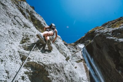 ★ 5.0Wildwire Wanaka- Level 2 (4 Hours)From $232467 reviews
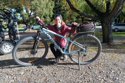 ★ 5.0Bike the Wanaka and Hawea TrailsFrom $80346 reviews
 ★ 4.6Lake Wanaka Happy Hour CruiseFrom $38313 reviews
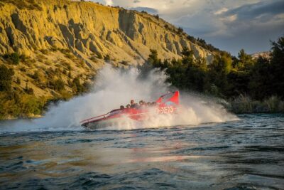 ★ 5.0Small Group Jet Boat Adventure on the Clutha River from WanakaFrom $98302 reviews
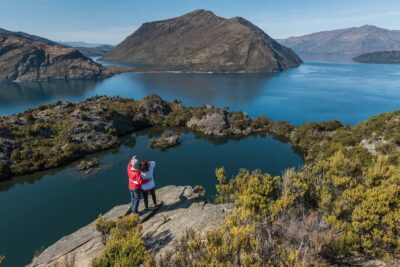 ★ 4.8Wanaka: Water Taxi & Mou Waho Island TourFrom $83299 reviews
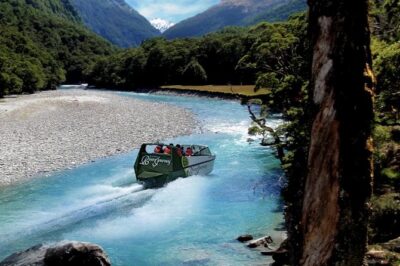 ★ 5.0Jet Boat and Wilderness Walk Tour from WanakaFrom $215259 reviews
 ★ 4.8Wanaka: Tandem Skydive ExperienceFrom $214252 reviews
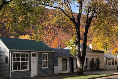 ★ 5.0Arrowtown and Wanaka Highlights Tour from QueenstownFrom $129252 reviews
Also filed under