

REVIEW · MOUNT COOK ALPINE DAY TRIPS
Mount Cook: Mountains High 40 minute Flight
Seeing Mount Cook from the air feels unreal. I like this Aoraki/Mt Cook helicopter flight because it gets you right over the Hochstetter Icefall and the upper ice world in a short, efficient hop.
You’ll also enjoy the chance for an alpine landing on snow (when conditions allow), which turns the trip from a scenic ride into real, in-your-face mountain time. The trade-off to keep in mind is that weather and snow levels can change the exact route and whether the snow landing happens.
Key highlights at a glance

- Hochstetter Icefall views from above, right where the ice does its most dramatic work.
- Upper Tasman Glacier scenery without the long hike.
- Alpine snow landing (conditions dependent) for photos and a quick taste of remote altitude air.
- Remote Burnett Mountains on the return leg, with Aoraki/Mt Cook facing you.
- Mackenzie Basin views below, including that big, arid sense of scale.
- Small group up to 6 with informative pilot commentary in English.
From Glentanner Park to real glacier views

This is a helicopter flight built for people who want Mount Cook views without spending half the day trekking. You depart from The Helicopter Line, Mount Cook in the Mount Cook area, then quickly head into one of the best aerial corridors for seeing Aoraki/Mt Cook and the surrounding ice.
A big reason I’d pick this over a simple scenic flight is the combination of famous landmarks and tight timing. In about 40 minutes total, you get high-impact views of major glacier features, plus the possibility of landing on snow. That is how you get value from limited time in South Island, New Zealand.
The part you will remember: Hochstetter Icefall and the upper Tasman Glacier
The first big moment is the pass over the Hochstetter Icefall on Aoraki/Mount Cook. From the air, icefalls look like frozen waterfalls, all broken texture and movement-like cracks. It is also a visual reminder of how active and changeable glaciers are, even if everything looks still from the ground.
Next comes the upper Tasman Glacier. This section matters because it gives you a different feel than the classic “big peak, big snow” postcard view. You see more of the glacier structure and scale, and you also get a sense of where ice sits in the bigger Mount Cook system.
If you care about photography, this is the window. You will likely find the light and angle are better in the air than during a long walk where you stop and start. Bring your camera and get ready to shoot quickly, because the helicopter line is all about motion.
The alpine snow landing: thrilling, but not guaranteed

One of the headline experiences here is a snow landing in a remote alpine location. The good news is that you can take epic photos and videos once you are on the snow, breathing in crisp alpine air that feels clean and sharp.
The honest consideration is that the snow landing is subject to snow levels. That means you should not book this with the expectation of a guaranteed walk around outside. You are buying access to a moment that depends on conditions, and the pilot will make the call based on what is safe and possible.
Even when conditions limit the landing, the flight is still designed to show you a strong mix of ice and mountain terrain. So if your main goal is Mount Cook from above, you are still in the right place.
The viewpoint photo stop, and why timing matters

On this flight, there is also a photo stop built into the experience, paired with sightseeing time during the aerial portion. This matters because helicopter tours can become a blur if there is no pause for cameras.
The other timing detail that helps you plan your expectations is that flight times are approximate and include your landing. In other words, the 40 minutes is not just air time. It is the full tour clock, including the on-snow moment if it happens.
Burnett Mountains on the way back, plus the Mackenzie Basin below

The return route is part of the magic. You fly back through the Burnett Mountains, with the range facing toward Aoraki/Mount Cook, so you get that satisfying sense of being framed by the peaks.
Then you look down into the Mackenzie Basin, which brings a completely different vibe. The basin’s vast, arid stretch gives you the scale of the region in a way that dense ice scenery sometimes hides. It is one of those views that makes you pause, because the terrain stops feeling like “mountains near a village” and starts feeling like a whole separate world.
If you are the type who loves context, this is where you get it. From the air, you see both the dramatic ice features and the big regional shape around them.
What makes the helicopter format feel worth it

Let’s talk value, because $391 per person is not a casual add-on. What you are paying for is access: you get a high-level aerial perspective on the Hochstetter Icefall, the upper Tasman Glacier, and the wider basin and mountain system, all packaged into a single 40-minute experience.
You also get an included setup that reduces friction. Informative pilot commentary is part of the flight, so you are not just staring out a window with no context. The experience is built around a small group, limited to 6 participants, which usually helps with attention and overall flow.
There are concession fees included too, contributing toward conservation and sustainability management. That does not make it cheaper, but it does mean your ticket is tied to managing impacts in a sensitive area.
Logistics that matter: group size, transport, and practical rules
This is a small group experience, and that is a comfort factor. With up to 6 participants, you are not fighting for space or waiting on a crowd. It also means your group gets coordinated more tightly during boarding and briefing.
If you are staying in Aoraki/Mt Cook Village, complimentary transportation can be provided to and from the village. That is useful because it reduces the “how do I get there on time” stress that can drag down a quick, scenic day.
Now the practical side. You’ll want warm clothing, a camera, and closed-toe shoes. Helicopter air can feel much colder than you expect, especially if you are landing on snow or stepping outside briefly.
Also, plan around the restrictions: drones, selfie sticks, and tablets/iPads are not allowed on board. If you rely on a tablet for photos, consider switching to your phone or camera. And if you like shooting handheld video, skip selfie sticks so you do not lose time at the check-in stage.
What the day feels like, from start to finish

Your experience begins at The Helicopter Line, Mount Cook. From there, you head out into Aoraki/Mount Cook National Park, and the flight soon lines up with the major ice and mountain features people come for.
The vibe is fast and focused. You are not looking at one view for a long time. Instead, you are moving between key sections: first the Hochstetter Icefall, then the upper Tasman Glacier, then possible alpine snow landing with time for photos and videos, and finally the return aerial route through the Burnett Mountains and across the Mackenzie Basin.
What I like about this format is that it feels like a highlight reel that actually stays coherent. You are not just collecting random photos, you are seeing a connected region: ice features, then the glacier system, then the wider basin and mountain boundaries.
Who this helicopter flight suits best

This is a strong fit if you want the biggest visual impact with the least time. It works well for:
- People who are short on time in the South Island
- First-timers who want a fast, high-context introduction to Aoraki/Mt Cook National Park
- Photography lovers who can handle quick moments and changing angles
- Anyone who prefers a guided flight with English pilot commentary instead of navigating trails
It is also wheelchair accessible, which opens it up to travelers who may not be able to hike to glacier viewpoints. If mobility is a key factor for you, this kind of access can make a huge difference.
The trip may feel less ideal if you need total control over exact route and landing. Because weather and the pilot’s discretion can affect routes and landings, you should be comfortable with the idea that nature sets the rules.
Booking confidence: confirmation and changing conditions
You should receive confirmation within 48 hours of booking, depending on availability. Flight times are approximate, and the operator notes that flights, landings, and routes may vary due to weather and the pilot’s discretion.
That is not a problem if you treat this as nature-led adventure. It is a key thing to remember for planning the rest of your day. If you have a tight schedule with no flexibility, you’ll want to leave some buffer.
Should you book this Mount Cook helicopter flight?
I’d book it if you want a top-tier aerial look at the Hochstetter Icefall and upper Tasman Glacier, and you are excited by the possibility of a snow landing. Even without the landing, the flight is designed to show you the main ice and mountain storylines of the park, plus the scale of the Mackenzie Basin on the return.
Skip it only if you hate the idea of condition-dependent parts. Since the snow landing depends on snow levels, you may want a Plan B for your expectations. Also, double-check what you bring: warm clothes, closed-toe shoes, and a camera are your best friends here.
If you are aiming for a memorable Mount Cook experience that packs a lot of meaning into a short window, this is one of the most direct ways to do it.
FAQ
How long is the helicopter flight?
The total duration is about 40 minutes, and flight times are approximate. The included time includes your landing.
Where does the flight start?
The starting location is The Helicopter Line, Mount Cook.
What will I see during the flight?
You’ll fly past the Hochstetter Icefall on Aoraki/Mount Cook and the upper Tasman Glacier, and you may also see the Burnett Mountains and the Mackenzie Basin.
Is the alpine snow landing guaranteed?
No. The alpine landing in snow is subject to snow levels.
Is there a photo stop?
Yes. The experience includes a photo stop and sightseeing time, plus time for photos and videos during the alpine landing if it happens.
Does the tour include pilot commentary?
Yes. The flight includes informative pilot commentary.
Is transportation provided from Aoraki/Mt Cook Village?
Complimentary transportation can be provided to and from Aoraki/Mount Cook Village.
What language is the live tour guide in?
The live tour guide and commentary are in English.
What should I bring?
Bring warm clothing, a camera, and closed-toe shoes.
What items are not allowed on board?
Drones, selfie sticks, and tablets/iPads are not allowed.
Is the experience wheelchair accessible?
Yes, it is listed as wheelchair accessible.
More Tour Reviews in Glentanner
- Mount Cook: Glentanner High Country Heli Hike
★ 5.0 · 7 reviews - Mount Cook: Alpine Explorer 35 Minute Flight
★ 4.9 · 6 reviews - Mount Cook: 20-Minute Alpine Vista Helicopter Flight
★ 4.2 · 5 reviews
Four Hours North to Aoraki
- Mount Cook: Glentanner High Country Heli Hike
★ 5.0 · 7 reviews - Mount Cook: Alpine Explorer 35 Minute Flight
★ 4.9 · 6 reviews - Mount Cook: 20-Minute Alpine Vista Helicopter Flight
★ 4.2 · 5 reviews
Mount Cook Alpine Day Trips, side by side.
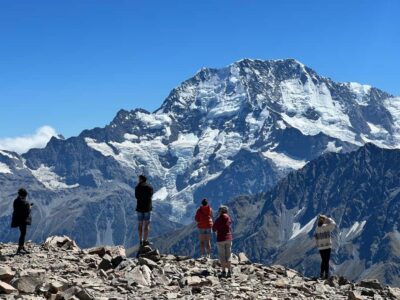 ★ 4.8Mount Cook: Scenic Helicopter Flight with Alpine LandingFrom $226442 reviews
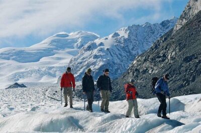 ★ 5.0Mt Cook Small Group Scenic Day Tour from QueenstownFrom $164407 reviews
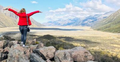 ★ 4.8From Queenstown: Mt Cook & Tasman Glacier Viewpoint Day TourFrom $146329 reviews
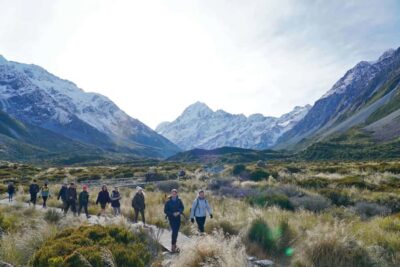 ★ 4.8Tekapo Shuttle: Mt Cook Day Tour via Pukaki & Tasman LakeFrom $89307 reviews
 ★ 4.6Mount Cook: Ski Plane and Helicopter Glacier Combo FlightFrom $328271 reviews
 ★ 4.7Small Group Mt Cook Day TourFrom $166262 reviews
 ★ 4.9Mount Cook: 3-Hour Tasman Glacier Helicopter Ride and HikeFrom $537235 reviews
 ★ 4.7Mount Cook: 3 Hour Heli Hike to the Tasman GlacierFrom $564218 reviews
Also filed under