

REVIEW · MOUNT COOK ALPINE DAY TRIPS
Mt Cook: 55-Minute Scenic Flight in Helicopter or Ski Plane
One part of New Zealand hits you in the face.
A 55-minute flight over Mt Cook turns huge peaks and glaciers into something you can actually picture, with an onboard guide who talks you through what you are seeing.
I like two things most: the flight route packs in Mount Cook National Park plus multiple glacier regions in one go, and the onboard commentary is clear and practical, so the views mean something. If you are lucky enough to fly with Angus (one of the pilots), you get that calm, confident feel in the cockpit that makes the whole ride easier to enjoy.
One drawback to weigh is seat placement. If you end up in the wrong spot, visibility can be limited, including seats where the viewing angle is blocked by the aircraft structure.
Quick hits before you book

- You get an expert, in-air guide delivering English commentary during the flight.
- Route hits big-name peaks around Mount Cook, Mount Tasman, and Mount Sefton.
- Glacier viewing reaches the West Coast with aerial passes over Franz Josef and Fox Glaciers.
- You can fly by ski plane or helicopter depending on the operation that day.
- Small group size, up to 6 people, keeps the experience feeling less crowded.
- Camera and phone are allowed, and you can use them during the flight.
Aoraki and the Southern Alps, compressed into 55 minutes

You do not come to Mt Cook for subtle sights. You come for scale. This scenic flight is a fast way to see the Southern Alps without committing days to hiking or driving long distances between viewpoints.
The key value here is the route. In under an hour, you cross major terrain zones and get views over the Main Divide, the Tasman Sea side, and the snow-and-ice world around Aoraki Mt Cook. Instead of looking at one peak at a time from the ground, you watch the geography unfold from above, and the guide helps you connect names to shapes.
Also, it is a small group. With a maximum of 6 participants, the safety briefing and the overall flow feel more controlled than the bigger-tour model. The flight stays focused on what you came for: aerial views with context, not a rushed checklist of stops.
Ski plane vs helicopter: choosing the right kind of sky time
This experience runs as either a Ski Plane or a Helicopter, and that choice can change how the flight feels.
A ski plane ride can be extra memorable if weather and conditions line up, because the aircraft can operate in the alpine ice environment. One guest described a flight where the plane landed and took off from a glacier, which is the kind of detail you only get with this kind of operation.
A helicopter flight is typically about flexibility and close-up angles. You might find it easier to line up on views when the aircraft is adjusting its position mid-route. That matters because part of your enjoyment depends on seeing the faces of peaks and the exact contours of glacier country.
Two practical notes based on what I know you will actually care about:
- Visibility can vary by seat. If you are worried about missing the center view, pick a seat thoughtfully when you can.
- This is not a long “hang in the air” ride. You have 55 minutes, so the aircraft type affects how quickly the scenery moves past you.
The full route: from the Main Divide to Aoraki’s east face

Here is the arc of the flight, in plain language, so you can mentally follow it.
You start by taking off and immediately get big views. The aircraft heads toward the Main Divide, and the guide’s commentary helps you recognize what you are looking at while you are still adjusting your eyes to the altitude and angle.
Then the route tracks west toward the West Coast. This is where you get aerial passes over Fox Glacier and Franz Josef Glacier. From above, glaciers look like slow-moving rivers made of ice, and you can often see where they spread, narrow, and snake through valleys. It is one of the rare moments in Mt Cook country where you can view multiple glacier systems without playing “guess the terrain” from a roadside turnout.
Next, you shift north along the Tasman Sea side. From that perspective, the coastline and the sea-air contrast can make the mountains look even steeper. Then you cross back over the snow-capped peaks of the Southern Alps toward the Tasman Glacier.
From there, the flight turns south again over Mt Cook National Park. You pass through the Grand Plateau and Hochsteter Icefall, and then the route comes under the east face of Aoraki Mt Cook. That part is special because you are seeing the mountain’s shape, not just its silhouette.
Finally, you descend over the Tasman Terminal Lake. Watching the transition from glacier terrain toward the lake area is a nice way to land the whole story of where the ice goes and how it feeds the landscape.
West Coast glacier views, explained from the air
When you see Franz Josef and Fox Glaciers from the ground, you tend to focus on distance and scale. From this flight, you can also focus on structure.
Here is why that matters. Glaciers are not just pretty ice. They are moving systems. Even at a glance from the air, you can often spot different sections that look smoother, rougher, wider, or narrower. That gives you a better sense of how the glacier occupies a valley.
The aerial view also reduces the “one viewpoint only” problem. Instead of one side of the glacier, you get a broader angle. The guide’s English commentary helps you keep your bearings, so you are not just snapping photos, you are learning what the features are called and why they matter.
And yes, you will probably want to shoot photos quickly right after takeoff and again when you cross major peaks. The most common mistake is spending too long fiddling with settings while the best angles slide past.
Tasman Glacier, Grand Plateau, and Hochsteter Icefall
If you want the names to mean something, this is the section of the flight that turns the brochure into a mental map.
After the West Coast passes, you come back over the Southern Alps toward the Tasman Glacier. That shift is important because it connects two glacier worlds: the West Coast glaciers on one side, and Tasman Glacier on the other.
Then comes the Grand Plateau, a broad, high-area passage that can feel like the Alps are laid out in layers. After that, you pass the Hochsteter Icefall. Icefalls can look like textured chaos from above, and that visual is the point. You are seeing how ice breaks and flows through steep terrain.
Finally, you move under the east face of Aoraki Mt Cook. This is the moment when the flight stops being just scenic and starts feeling like you are in the geography, close enough to understand how the mountain dominates the region.
What makes the guide part worth it
You could buy a ticket and just stare out the window. But the value here is the onboard guide, speaking English, giving you commentary while you fly.
That matters because Southern Alps country can look similar if you are not sure what you are seeing. Names like Mount Tasman, Mount Sefton, Tasman Glacier, and Hochsteter Icefall help you turn visual impressions into a clear, remembered route.
The safety briefing is included too. It is not the flashiest part of the day, but it sets expectations quickly. You know what is and is not allowed, and you know how the crew wants you to behave once you are airborne.
Also, you have a small group. That means you are not stuck listening to other people’s questions from across a big cabin. You get a calmer experience and more consistent attention from the team.
Price and value: what $447 buys in 55 minutes
At $447 per person for a 55-minute flight, you should think of this as “paying for access.” You are paying to see a multi-region alpine circuit that is hard to replicate in a day on the ground.
You are not just paying for time in the air. You are paying for:
- A guided route that strings together multiple named mountains and glaciers
- Small-group operation (up to 6 people)
- Expert aircraft operation in alpine conditions, whether it is a ski plane or helicopter
- A safety briefing included with the experience
Is it expensive? Yes, if you measure it by minutes. But if you measure it by what you get in one shot, it is easier to justify. You are getting a panoramic understanding of the Southern Alps that would usually take a mix of drives, viewpoints, and hikes to approximate.
Also, there are no included food and beverages. That can be a downside if you were hoping the flight ticket would cover the full outing. On the bright side, it keeps the experience tightly focused, and you can plan your meal before or after with your own schedule.
Weather reality: why flexibility is part of the deal

Mt Cook weather can change fast, and this operation is built around that reality. If the flight is canceled due to weather, you will either get a full refund or a rescheduled tour.
There is also a rare situation where a flight might be rescheduled because the combined weights of passengers reach the maximum safety limit. That is not something you can control, but it explains why plans can shift even when the forecast looked fine earlier.
The upside is the team tends to work with people. One guest described a chain of changes: a shorter flight after a weather change, then a canceled flight due to weather, then an accommodation to fit them onto a helicopter instead. That kind of problem-solving is what you want in a place where conditions are not predictable.
Practical tips: clothes, bags, selfie sticks, and seats
This part is small, but it affects how smoothly your flight goes.
Bring comfortable clothes. Wear what you would wear in cool alpine air, since you are flying in open or semi-enclosed conditions depending on the aircraft type. Sunglasses can help too, because glare on snow and ice is real.
Leave bags behind. Bags are not allowed. Selfie sticks are not allowed either. These rules are about safety and space in the cabin, and they also make it easier for the crew to keep things organized.
The good news: you can use your camera and phone during the flight. That means you can shoot without having to stash everything away the moment you get airborne.
One more practical consideration is seat choice. If you are concerned about visibility, remember there is at least one reported case where visibility was poor from a middle seat behind aircraft structure. When seat options exist, treat them as part of your planning, not an afterthought.
Who should book this flight, and who should skip it
This is a great option if you:
- Want a fast, high-impact introduction to the Southern Alps
- Prefer guided context to figuring out geography alone
- Like glacier scenery and want to see multiple regions in one go
- Are traveling with limited time and do not want to spend all day on roads
It is not suitable if you have mobility impairments. It is also not suitable for people over 254 lbs (115 kg).
If you fall into those categories, you will likely be happier with a different kind of Mt Cook experience that matches your needs better.
Also, if you are the kind of traveler who gets stressed by changing plans, this might still be okay, but go in with the mindset that weather can affect flights. This is not a rigid, guaranteed takeoff no-matter-what situation.
Should you book the Mt Cook scenic flight?
Book it if you want the most direct route to understanding Aoraki and the Southern Alps, and you are comfortable paying for access. The flight route hits named peaks and glacier regions in one 55-minute circuit, and the English guide commentary is the difference between a fun ride and a genuinely memorable one.
Skip it if you know you hate being constrained by safety rules like no bags and no selfie sticks, or if you are likely to feel frustrated by seat-dependent visibility. Also, consider your aircraft comfort and mobility needs since the experience is not designed for mobility impairments.
If you are flexible and you like big views with a bit of guidance, this is one of the most efficient ways to experience this part of the South Island.
FAQ
What is the duration of the Mount Cook scenic flight?
The flight lasts 55 minutes.
Where does this experience take place?
It is located in the South Island of New Zealand, around Mt Cook and the Southern Alps.
What aircraft are used, ski plane or helicopter?
The flight is offered in either a ski plane or a helicopter.
What is included in the price?
The price includes the 55-minute scenic flight and a safety briefing.
Are food and beverages included?
No, food and beverages are not included.
What language is the guide?
The live tour guide provides commentary in English.
Can I cancel for a full refund?
Yes. You can cancel up to 24 hours in advance for a full refund.
Is there a weight limit?
Yes. It is not suitable for people over 254 lbs (115 kg).
More Tour Reviews in Mount Cook
- Mount Cook: Scenic Helicopter Flight with Alpine Landing
★ 4.8 · 442 reviews - Mt Cook Small Group Scenic Day Tour from Queenstown
★ 5.0 · 407 reviews - Mount Cook: Ski Plane and Helicopter Glacier Combo Flight
★ 4.6 · 271 reviews - Mount Cook and The Glaciers 55-Minute Helicopter Flight
★ 4.5 · 133 reviews
Above the Main Divide
- Mount Cook: Scenic Helicopter Flight with Alpine Landing
★ 4.8 · 442 reviews - Mount Cook: Ski Plane and Helicopter Glacier Combo Flight
★ 4.6 · 271 reviews - Mount Cook and The Glaciers 55-Minute Helicopter Flight
★ 4.5 · 133 reviews - Mount Cook: Mountains High 40-Minute Helicopter Flight
★ 5.0 · 53 reviews
Four Hours North to Aoraki
- Mount Cook: Scenic Helicopter Flight with Alpine Landing
★ 4.8 · 442 reviews - Mt Cook Small Group Scenic Day Tour from Queenstown
★ 5.0 · 407 reviews - Mount Cook: Ski Plane and Helicopter Glacier Combo Flight
★ 4.6 · 271 reviews - Mount Cook and The Glaciers 55-Minute Helicopter Flight
★ 4.5 · 133 reviews
Mount Cook Alpine Day Trips, side by side.
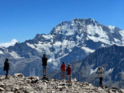 ★ 4.8Mount Cook: Scenic Helicopter Flight with Alpine LandingFrom $226442 reviews
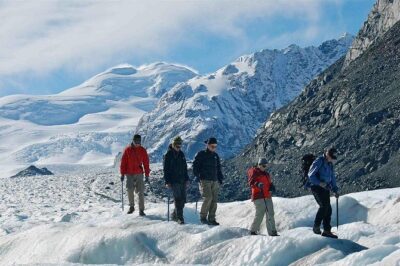 ★ 5.0Mt Cook Small Group Scenic Day Tour from QueenstownFrom $164407 reviews
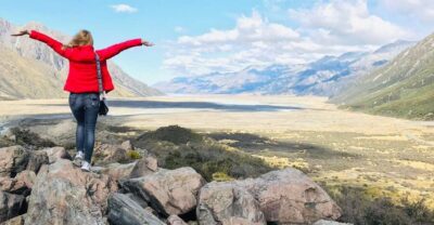 ★ 4.8From Queenstown: Mt Cook & Tasman Glacier Viewpoint Day TourFrom $146329 reviews
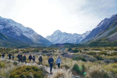 ★ 4.8Tekapo Shuttle: Mt Cook Day Tour via Pukaki & Tasman LakeFrom $89307 reviews
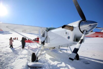 ★ 4.6Mount Cook: Ski Plane and Helicopter Glacier Combo FlightFrom $328271 reviews
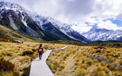 ★ 4.7Small Group Mt Cook Day TourFrom $166262 reviews
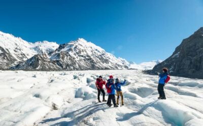 ★ 4.9Mount Cook: 3-Hour Tasman Glacier Helicopter Ride and HikeFrom $537235 reviews
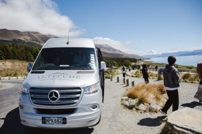 ★ 5.0Full-Day Guided Sightseeing Tour of Mount Cook from QueenstownFrom $173218 reviews